Staten Island was the only New York City borough where traffic fatalities increased in 2025. Brooklyn, Queens, the Bronx, and Manhattan all recorded fewer deaths. Staten Island went from 12 to 13. An 8% increase in a year when every other borough improved. The full borough breakdown is in NYC DOT’s January 2026 traffic fatalities report.
The raw numbers are smaller than the other boroughs. Staten Island has roughly 498,000 residents, the smallest population of the five. But the per-capita numbers tell a different story.
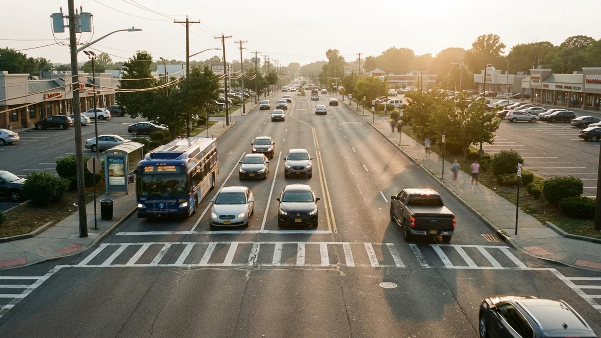
Residents are more car-dependent than any other borough. 83% of households own a car, the highest rate of any borough. Manhattan is 22%. Sixty-four percent of commuters drive to work, compared to less than 30% citywide. More driving means more exposure. The borough’s road design reflects its suburban character: wide lanes, high speeds, strip-mall arterials, and long distances between crosswalks.
Staten Island by the Numbers
NYC DOT’s January 2026 report on 2025 traffic fatalities:
| Borough | 2024 Deaths | 2025 Deaths | Change |
|---|---|---|---|
| Queens | 74 | 57 | -23% |
| Brooklyn | 69 | 63 | -9% |
| Bronx | 54 | 33 | -39% |
| Manhattan | 44 | 39 | -11% |
| Staten Island | 12 | 13 | +8% |
Every other borough moved in the right direction. Staten Island moved in the wrong one.
The borough recorded approximately 3,800 total crashes in 2024, with roughly 1,600 resulting in injuries. Those numbers are lower than the other boroughs in absolute terms. But Staten Island has fewer road miles. The crash rate per vehicle mile driven is comparable to the citywide average. In some corridors, it exceeds it.
Contributing factors in Staten Island crashes follow a pattern driven by road design and driving culture:
| Cause | Share of Crashes |
|---|---|
| Distracted driving | 32% |
| Failure to yield | 18% |
| Unsafe speed | 15% |
| Following too closely | 12% |
| Running red lights/stop signs | 8% |
| Intoxication | 5% |
Speed is a larger factor on Staten Island than in the denser boroughs. The wide, straight roads encourage it. Posted limits of 25 mph are routinely exceeded on arterials like Hylan Boulevard, Richmond Avenue, and Victory Boulevard.
Hylan Boulevard: The Borough’s Most Dangerous Corridor
Hylan Boulevard stretches approximately 14 miles along Staten Island’s eastern shore, from St. George in the north to Tottenville at the southern tip. It’s the longest street in any single NYC borough. By total crash volume, it’s the most dangerous road on Staten Island. Transportation Alternatives has called it the “Boulevard of Death.”
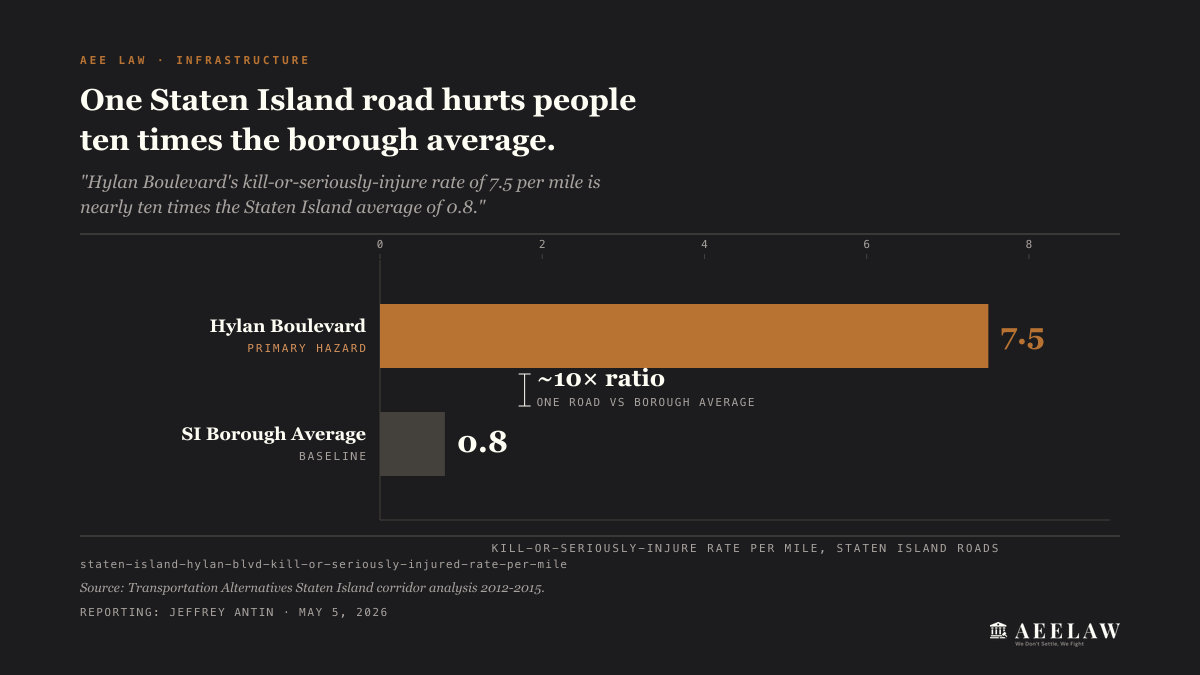
The numbers bear that out. Between 2012 and 2015, Hylan Boulevard produced 1,231 injuries and 14 fatalities, per the Transportation Alternatives corridor analysis. The road carries approximately 44,000 vehicles per day at peak intersections. Its deadliest stretch, the Satterlee Street to Page Avenue segment, runs a kill-or-seriously-injure rate of 7.5 per mile. That’s more than nine times the Staten Island average of 0.8 and over two and a half times the citywide average of 2.9, per NYC DOT’s Hylan Boulevard street improvement project. The NYC DOT Vision Zero Staten Island Pedestrian Safety Action Plan documents the corridor’s danger.
In the Transportation Alternatives 2012 to 2015 corridor data, six of the ten most dangerous intersections on Staten Island sit on Hylan Boulevard:
| Intersection | Crashes |
|---|---|
| Hylan Blvd & Allison/Ebbitts St | 43 |
| Hylan Blvd & New Dorp Lane | 37 |
| Hylan Blvd & Nelson Ave | 29 |
| Hylan Blvd & Richmond Ave | 28 |
| Hylan Blvd & Guyon Ave | 22 |
| Hylan Blvd & Old Town Rd | 22 |
The commercial stretches between New Dorp Lane and Nelson Avenue concentrate the worst of it. These sections combine:
- Strip-mall driveways that force left turns across traffic
- Bus stops where MTA buses pull in and out of traffic lanes
- Wide lanes that encourage speeds above the posted 25 mph limit
- Long blocks with few signalized crosswalks for pedestrians
Speed cameras along Hylan Boulevard issue some of the highest violation volumes on Staten Island, a measure of how routinely drivers exceed the posted limit on the corridor.
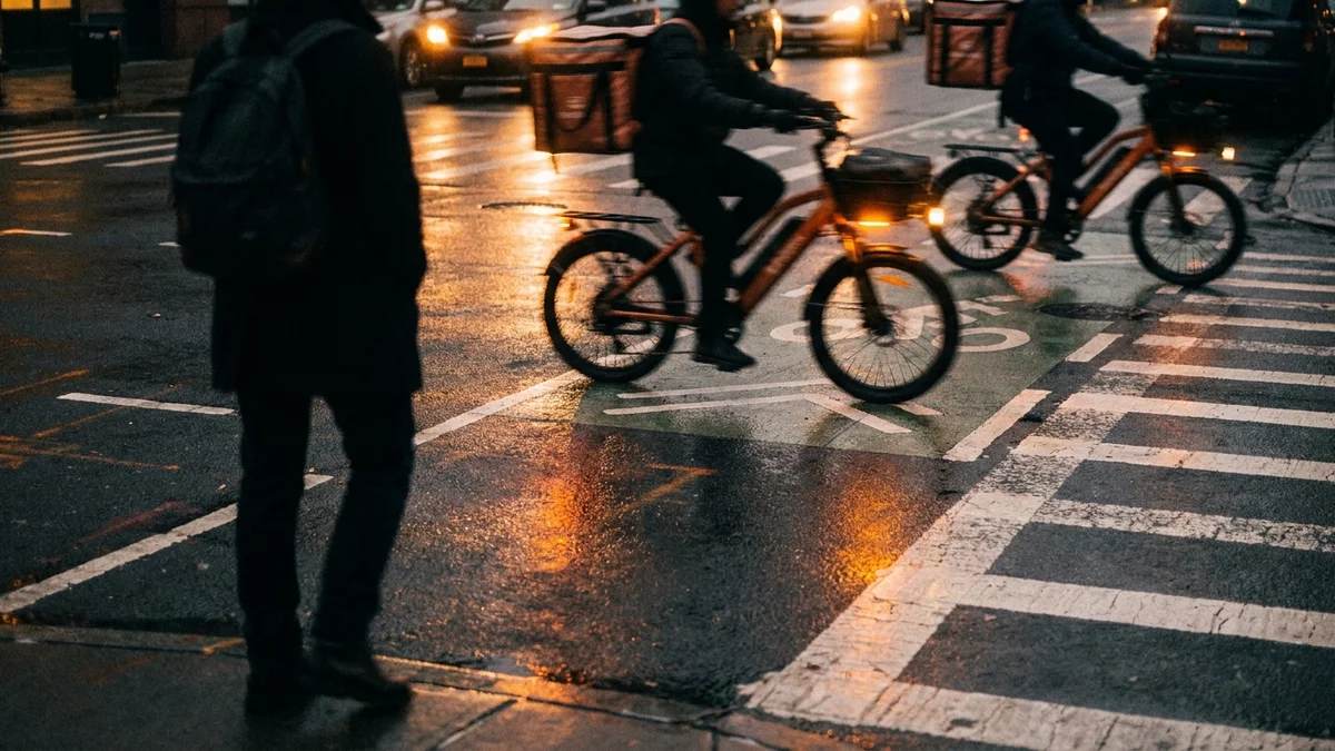
Cyclists account for only 1% of traffic on Hylan Boulevard but suffer 12% of injuries. The road has no protected bike infrastructure along most of its length.
In 2022, NYC DOT moved to narrow the section between Satterlee Street and Page Avenue from four lanes to three, adding bike lanes and left-turn bays. DOT pointed to comparable road diets elsewhere in the city to justify the change. On Allerton Avenue in the Bronx, the same kind of conversion cut injury crashes 28%.
Staten Island Expressway: Highway Risk
The Staten Island Expressway (I-278) is the borough’s only major highway, connecting the Verrazano-Narrows Bridge to the Goethals Bridge. In 2023, NYPD collision data recorded 407 crashes on the expressway: 131 resulted in injuries and 1 in a fatality. Speeding is cited as a leading factor in more than half of serious crashes on this road.
The expressway was built in the 1960s with a capacity it now far exceeds. Rush-hour congestion produces rear-end collisions. The merge zones at the Verrazano approach and the Goethals Bridge toll plaza are the highest-crash segments.
Recent fatal crashes illustrate the severity. In September 2023, two 22-year-old women were killed when a Corvette lost control near Hylan Boulevard, struck a barrier, overturned, and caught fire. In October 2025, three men ages 25 to 27 died when their vehicle lost control near Victory Boulevard at 4:19 a.m. It hit a barrier and overturned.
Truck traffic on the expressway is disproportionate. The road is a key freight corridor between port facilities in Elizabeth, New Jersey and the rest of the metro area. Large trucks in mixed traffic on a congested, aging highway produce severe crashes. When a tractor-trailer rear-ends a sedan on the expressway at even moderate speed, the injury severity escalates sharply.
Richmond Avenue and Victory Boulevard
Two north-south and east-west arterials account for a significant share of Staten Island’s off-expressway crashes.
Richmond Avenue
Richmond Avenue runs approximately 7 miles through the central spine of Staten Island, from Bulls Head to Tottenville. The road passes through the Staten Island Mall area, one of the borough’s busiest commercial zones. Turning movements into and out of parking lots create constant conflict.
The section near the Mall and Richmond Avenue/Platinum Avenue is a crash cluster. Drivers exiting the Mall merge into fast-moving arterial traffic. Pedestrians crossing Richmond Avenue to reach bus stops face a four-lane road with limited refuge islands.
South of the commercial zone, Richmond Avenue narrows and passes through residential areas where speed remains high. The transition from commercial to residential creates a mismatch between road design and actual conditions.
Victory Boulevard
Victory Boulevard runs east-west across the northern half of Staten Island. It connects the ferry terminal area to the expressway and western neighborhoods. The road carries heavy commuter traffic during morning and evening rush.
The intersection of Victory Boulevard and Jewett Avenue is flagged as a Vision Zero priority location. The geometry forces complicated turning movements. Pedestrian crossing distances exceed 60 feet.
Pedestrian Risk on Staten Island
Pedestrian crashes on Staten Island follow a pattern shaped by the borough’s suburban road network. Unlike Manhattan, where pedestrian crashes happen at dense intersections, Staten Island pedestrian crashes often happen mid-block.
The reason: crosswalks are spaced far apart. A pedestrian who needs to cross Hylan Boulevard may face a quarter-mile walk to the nearest signalized crossing. Many choose to cross mid-block instead. That puts them in a road environment where drivers are traveling at 35 to 40 mph and not expecting someone on foot.
Senior citizens are disproportionately affected. Staten Island has one of the oldest population profiles of the five boroughs. Older pedestrians are more vulnerable to severe injury and death when struck. The borough’s limited sidewalk network in some neighborhoods forces pedestrians onto road shoulders, adding further risk.
In 2024, pedestrian fatalities on Staten Island included crashes on Hylan Boulevard, Victory Boulevard, and Arthur Kill Road. Several involved drivers making left turns at intersections where pedestrian signal timing was inadequate.
The Cycling Gap
Staten Island has the least bicycle infrastructure of any NYC borough. The borough has no protected bike lanes on its major arterials. Cycling on Hylan Boulevard, Richmond Avenue, or Victory Boulevard means riding in mixed traffic at speeds that regularly exceed 35 mph.
In 2024, approximately 120 cyclists were injured on Staten Island. Given the borough’s low cycling mode share, this number reflects the danger per trip rather than aggregate volume.
The borough’s geography works against cycling infrastructure. Distances between destinations are long. Hills in the central ridge make casual cycling impractical for many trips. But the lack of any protected infrastructure means cyclists who do ride, including delivery workers on e-bikes, face conditions more experienced cycling cities would consider unacceptable.
DWI: A Persistent Problem
Driving while intoxicated accounts for a larger share of fatal crashes on Staten Island than in any other borough. The car-dependent culture combines with limited late-night transit options. After midnight, the only way off or onto Staten Island by transit is the Staten Island Ferry, service every 30 minutes. No subway service.
Multiple fatal crashes on Staten Island in recent years have involved intoxicated drivers. The pattern is consistent: late-night or early-morning hours, high-speed arterials, and drivers who chose to drive because the alternatives were inconvenient or unavailable.
What This Means for Injured Staten Island Residents
Staten Island’s crash patterns are shaped by infrastructure, not randomness. Wide roads designed for speed, commercial corridors without pedestrian protection, and a car-dependent borough that lacks the transit alternatives available in the rest of the city.
When you’re injured at a location with a documented crash history, the city’s failure to address known dangerous conditions can support a negligence claim. Prior crash data from NYC Open Data Motor Vehicle Collisions, Vision Zero priority designations, and community board requests for safety improvements all serve as evidence.
Staten Island car accident cases are filed in Richmond County Supreme Court at 18 Richmond Terrace. The courthouse is steps from the ferry terminal. We’ve handled car accident cases across all five boroughs for more than 25 years. We know the roads, the courts, and the insurance adjusters who handle Staten Island claims.
If you were injured on Hylan Boulevard, the Staten Island Expressway, Richmond Avenue, Victory Boulevard, or any other dangerous Staten Island road, contact us for a free consultation.
Call 212-221-5999 or request a free case review.