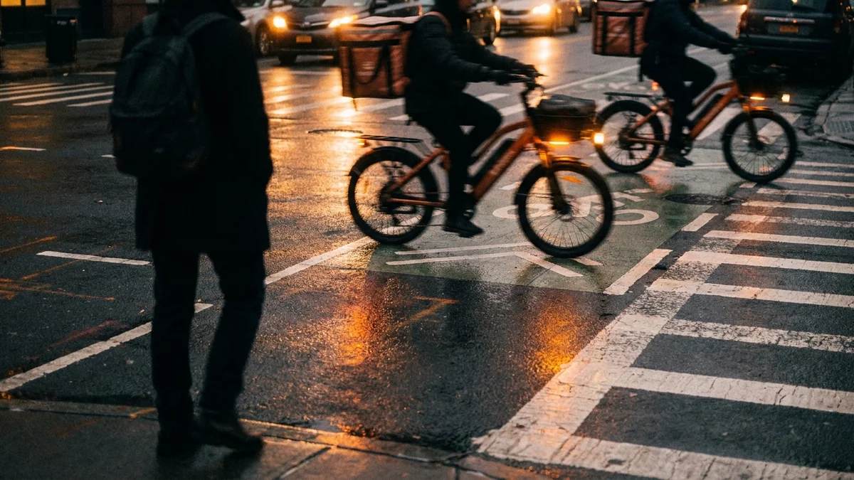
Brooklyn leads all five boroughs in total vehicle collisions. The borough recorded 22,890 crashes and 49 traffic deaths in 2023. In Q1 2025 alone, Brooklyn saw 5,479 crashes, again the highest of any borough.
Certain intersections produce a concentrated share of those injuries and fatalities. NYPD collision data from NYC Open Data, Vision Zero priority lists, and Transportation Alternatives’ December 2025 analysis identify the worst offenders. These are not random locations. Each one shares structural features that make collisions predictable.
1. Tillary Street and Flatbush Avenue Extension
A NYC DOT study found this intersection averages 37 crashes a year, with 112 people injured over the three-year study window. Flatbush Avenue is a Vision Zero priority corridor, one of the most dangerous streets in the borough.
Tillary Street is the funnel point for Brooklyn Bridge and Manhattan Bridge traffic. It handles enormous volumes of vehicles moving between local streets and highway-speed bridge approaches.
Drivers accelerate toward the bridges while pedestrians try to cross wide, fast-moving roadways. Cyclists coming from the Brooklyn Bridge path to local streets face the sharpest risk. Vision Zero has classified this as a priority corridor.
2. Atlantic Avenue and Pennsylvania Avenue
This East New York intersection sits on one of the borough’s highest-crash corridors.
Two major arteries with dangerous turning patterns and high-speed traffic create constant conflict. Atlantic Avenue’s six lanes carry heavy bus and truck traffic. Pennsylvania Avenue adds commercial vehicle volume from the surrounding industrial and retail areas.
3. Atlantic Avenue and Flatbush Avenue
This junction in Downtown Brooklyn is one of the most collision-prone intersections in the entire city.
Six lanes of Atlantic Avenue meet the angled approach of Flatbush Avenue. Long pedestrian crossings and awkward turning geometries make this intersection treacherous.
Drivers heading toward Barclays Center contend with delivery trucks, MTA buses, and rideshare vehicles. Left turns from Atlantic onto Flatbush are hazardous due to limited sight lines past stopped vehicles. Pedestrian crashes spike during evening events at Barclays Center.
4. Flatbush Avenue and Avenue H
Transportation Alternatives data shows eight people were killed or seriously injured at this intersection since January 2022.
The crossing combines high-speed Flatbush Avenue traffic with a residential cross-street. The speed differential between through traffic and turning vehicles creates conflict. Pedestrians face long crossing distances with limited protection.
5. Linden Boulevard and Rockaway Parkway
Deep in Canarsie, this intersection sits on one of Brooklyn’s most dangerous corridors.
Linden Boulevard works like a highway through East Brooklyn. It is wide, fast, and harsh. Adding turning traffic from Rockaway Parkway’s shops makes it worse. This corridor through Canarsie and Brownsville is one of Brooklyn’s worst for crashes.
6. Ocean Parkway and Church Avenue
A wide boulevard meets a busy commercial cross-street in Kensington.
Ocean Parkway is a divided road with service roads on each side. Walkers must cross multiple lanes of traffic. Church Avenue carries heavy east-west traffic. Cars on the service roads turn right across crosswalks while through traffic adds a second layer of risk. The full crossing distance is over 100 feet.
7. Pennsylvania Avenue and Linden Boulevard
East New York’s primary commercial corridor meets another section of Linden Boulevard.
Heavy truck and commercial vehicle traffic flows along both roads. Short signal cycles don’t give pedestrians enough time to cross. East New York has some of Brooklyn’s highest per-capita crash injury rates, and this intersection concentrates the risk.
8. Nostrand Avenue and Eastern Parkway
A major Crown Heights intersection where north-south Nostrand Avenue traffic meets Eastern Parkway’s east-west flow.
Eastern Parkway is wide and fast. Nostrand Avenue is a busy shopping strip with cars double-parked in travel lanes. MTA buses converge here too, adding big vehicles to the mix.
9. Fourth Avenue and Atlantic Avenue
The wide expanse of Fourth Avenue crosses Atlantic at a point where Boerum Hill, Park Slope, and Downtown Brooklyn converge.
Fourth Avenue is one of Brooklyn’s widest roads, essentially a six-lane boulevard. Atlantic Avenue adds another wide, fast-moving stream. The intersection covers a large footprint with long pedestrian crossings and multiple turn lanes. Both corridors rank among Brooklyn’s most dangerous.
10. Utica Avenue and Eastern Parkway
Another Eastern Parkway crossing in Crown Heights.
Similar dynamics to the Nostrand Avenue intersection: wide roads, heavy traffic, high pedestrian volumes. The proximity to several schools and the Utica Avenue commercial district adds pedestrian density. Utica Avenue is one of Brooklyn’s most crash-prone north-south corridors.
Common Threads
These 10 intersections share characteristics that explain their crash rates:
- Wide roads with multiple travel lanes that encourage speed and increase pedestrian exposure time
- Heavy commercial and truck traffic that creates blind spots and turning hazards
- Inadequate pedestrian crossing time relative to road width
- Angled intersections and complex geometry that increase driver decision-making load
In Brooklyn car accident cases, the intersection itself is often part of the legal picture. Was the signal timing adequate? Were crosswalks properly marked? Were sightlines blocked? When the city fails to address known dangerous conditions, that failure can support a negligence claim.
What This Means for People Who Are Injured
If you’re hurt at one of these intersections, several legal considerations apply.
Multiple liable parties. The driver who hit you is the obvious target. But the City may also be at fault if bad road design or poor upkeep played a role. City claims need a Notice of Claim filed within 90 days under General Municipal Law § 50-e.
Crash history as evidence. If an intersection has a long record of crashes, that helps prove the city knew it was dangerous and did nothing. This is called “constructive notice,” and it’s a strong tool in road safety cases. The NYC Open Data Motor Vehicle Collisions dataset is publicly available and searchable by intersection.
Side-impact crashes are worse. T-bone crashes, where a car hits you from the side, cause worse injuries than rear-end hits at the same speed. The side of a car has less structure to absorb the blow. Broken bones, internal injuries, and brain injuries are common.
Frequently Asked Questions
Can I sue the city if a dangerous intersection caused my accident?
Yes, if the city’s failure to maintain safe conditions contributed to the crash. You’ll need to file a Notice of Claim within 90 days and a lawsuit within one year and 90 days. Evidence of prior crashes at the same location strengthens these claims.
How do I get crash data for a specific Brooklyn intersection?
The NYPD Motor Vehicle Collision dataset is publicly available through NYC Open Data. You can also explore collision locations using the interactive Vision Zero View map at vzv.nyc. Your attorney can subpoena the city’s internal traffic safety records for a specific intersection.
Does Brooklyn have more crashes than other boroughs?
Yes. Brooklyn consistently leads all five boroughs in total collisions. The borough had over 5,400 in Q1 2025 alone. Queens ranks second, followed by Manhattan, the Bronx, and Staten Island.